by user | Jun 9, 2026 | Latest News, What's New
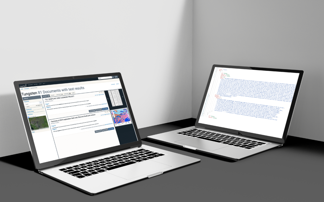
GeoClerk Launches API for Programmatic and Agentic Access to the World's Largest Corpus of Sub-Surface Exploration Text & Imagery The exploration intelligence geoscientists have searched by hand for years is now callable by code (and ai agents) spatially, textually,...

by user | May 1, 2026 | What's New
Two more Provinces, Thousands more Possibilities 01.05.2026 GeoClerk’s Canadian coverage grows wider, with the addition of exploration assessment files and geological publications from Manitoba (iMaQs) and New Brunswick (PARIS). This expansion adds thousands of...

by user | Feb 26, 2026 | What's New
Personalised Location - Aware News Feed 26.02.2026 Staying on top of the news that actually matters to you with GeoClerk’s new customisable news feed. Filter incoming announcements by commodity, company, mineralisation stye, or area of interest to create a...
by user | Jan 30, 2026 | What's New
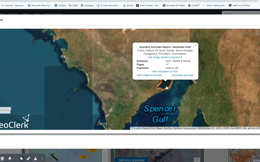
ASX and TSX Documents Now Spatially Searchable 30.01.26 Finding the right information in regulatory filings no longer means wading through thousands of PDFs. Through GeoClerk’s proprietary document processing workflows, ASX and TSX filings are enriched with critical...
by user | Oct 8, 2025 | What's New
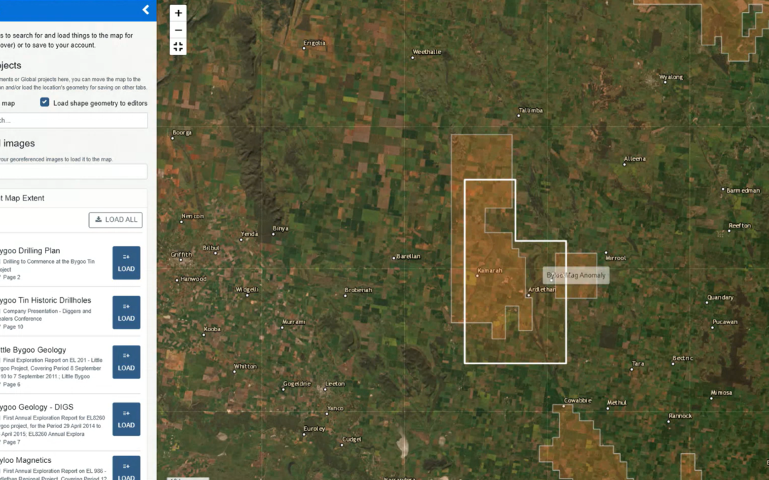
Layer it on - Smarter Maps in GeoClerk 08.10.2025 We’ve rolled out another upgrade to GeoClerk’s spatial tools – this time making working with layers far more powerful and flexible. Previously, only a single georeferenced image could be loaded into the viewer,...
by user | Aug 29, 2025 | What's New
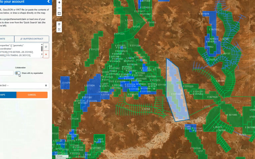
Spatial Viewer Update 29.08.25 We’ve given the Spatial Viewer a bit of a makeover! All the controls have moved right into the map itself, so no more hopping over to the sidebar. This means you can go full screen to georeference images, work with shapes and have...
Recent Comments